Sunday 30 March 2014

Lea Castle Co. Laois


                                      Above Image: Part of the courtyard wall

                                              Above Image: A gate tower


                       Above 3 Images: Some of the numerous 'nooks and crannies'


                                              Above Image: The stairwell

                                      Above Image: A view from the river below

                                           Above Image: A vaulted basement


                                Above Image: Trees literally melded into the walls


                            Above Image: The River Barrow Adjacent to the Castle


                                            Above Image: A sea of mud.....


Lea Castle was a huge Keep fortified by four towers and defended by a portcullis gate. It was constructed by William DeVesey in 1260 on the South bank of the River Barrow on elevated ground. Throughout it's turbulent history it included many owners, the Fitzgeralds, the O'Kellys, the O'Dempseys and even the Earl of Ormond. It was attacked and burned in 1294, 1315 (by Edward the Bruce) and again in 1346. By the 1640's rebellion was in progress and the Confederate Catholics took occupation. In 1650 this ended when Cromwell's enforcer in Ireland Col. John Hewson destroyed the Castle with a massive amount of explosives leaving only one of it's four corner towers remaining. What also remains today are parts of the double towered gatehouse, a section of the keep and outer ward walls.
I passed this Castle about 20 years ago and remember that it was on private land. I couldn't get access then but I do remember spotting a figure sitting on an exposed ledge on the first level reading a book! So I reckoned there had to be a way of getting in. It didn't happen that day but now 20 years later we decided to take a trip out again and try our luck. This visit became what I could only term "an adventure in mud....."
As it happens the Castle is still on private farmland and a large locked gate through a farmyard down a narrow country lane offers the only direct access. There was no one in the yard and in the general vicinity there appears to be quite a lot of signs posted relating to a local gun club a police text alerts. With this in mind we sought out the location of the landowners house by enquiring at a house on the lane who directed us to the right person. I have to say the farmer was a very pleasant gentleman who had no quibble about us wanting to see the Castle but advised us that boots were essential as there was mud....a lot of mud. The Castle is situated beside the Barrow river and I don't know if it is the river or the constant use of the surrounding fields for cattle that has contributed in making the approach to the ruins such a quagmire. Anyway having traversed the tall gate and tramped through the mud, nearly losing a boot at one stage, we followed the farmer's directions across a field and through a broken section of a barbed wire fence. Once you reach the ruins the land is drier and easy enough to walk on.
These are really great ruins. There are so many nooks and crannies to explore and you can even walk down to the river and take a look back up at the Castle and see how imposing and strategically placed it would have been.
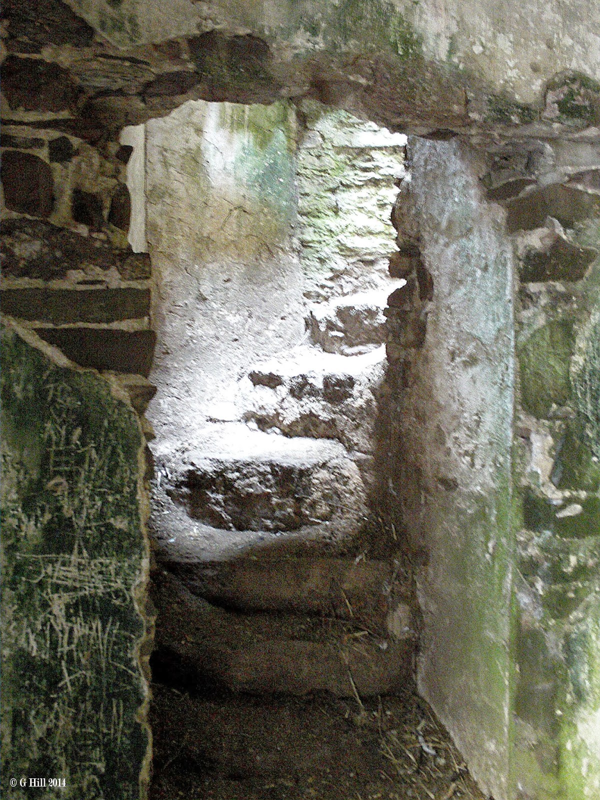
Within the walls there is a really worn set of stone steps that bring you up onto I might say a fairly dangerous viewpoint. Some sections of the steps have crumbled so a lot of due care is needed here especially when your boots are muddy and slippery. You can also find access to the vaulted basements which are quite creepy. The outer enclosure is clogged with overgrowth and some trees have melded with the walls but parts are still accessible.
The Farmer informed us that a local group are lobbying to have the Castle cleaned up and made accessible to the public. While I welcome this I would urge you to try and see the ruins in their raw state before any clean up begins. A trek through the many arches and damaged walls just oozes with history.
Within the ruins you can really see the destruction wreaked by Hewson and his explosives. This once fine fortress could never be the same again.
This was one of our favourite ruin hunts and I would certainly be going back again for another view.
To find Lea Castle take the Dublin to Limerick motorway and exit at junction 14. Cross over the motorway bridge to the other side and you will come to a T-Junction with the R445. Turn left and drive for approx. 4KM until you reach Monasterevin. Drive through the Town until you see a right hand turn at a tall stone Celtic cross. Turn right here and continue along this road (R424) for about 5KM until you reach junction with the R420. Turn right onto the R420 and drive for approx. 1KM and you will see a right turn posted for the L7176. You will spot the Castle in the distance. Turn right onto this narrow road and continue for approx. 500m until you will see a farmyard gate with a derelict house on your left. You can park on a grass verge just before the gate. It is best to seek permission before entry and this can be sought at the first bungalow on the right just past the entrance to the L7176 on the main R420 road.

Friday 21 March 2014

Lady's Island Castle & Church Co Wexford


                                      Above Image: The gatehouse entrance


                                        Above 2 Images: The leaning tower

                                    Above Image: Entrance to the graveyard

                                  Above & below Images: St Abban's Church


                              Above Image: The shrine attached to the Castle


Situated on an isthmus jutting into Lady's Island lake this group of ruins are positioned in an area long renowned for pilgrimage. Indeed when we last visited there in August there were quite a few people around the Church area but luckily for us not so congested at the ruins.
The remains of this Tower house built by Rudolph DeLamporte in 1237 continued in use until the Cromwellian invasion in 1649 in which the castle was burnt and plundered and the surrounding lands passed to the Browne family.
The Tower house today still stands to four storeys high and there appears to be a little renovation in progress. The whole area is an important religious shrine so I think the ruins may be benefiting from the general ongoing upkeep. The North wall of the Castle now has attached to it a modern shrine to Our Lady. There are apparently stairways within the tower that lead to a wall walk but these were not accessible on our visit.
The entrance to the courtyard is through the arches of a sturdy gatehouse which is attached to the tower and on either side of these structures are fragments of a curtain wall.
A few yards North of the Tower house are the remains of a curtain wall tower which now leans precariously at a 30 degree angle. Surprisingly this has thankfully not been demolished but simply cordoned off by a low fence and left for people to gasp at. It teeters with it's innards exposed and in this particular position is very striking looking indeed. The leaning tower of Lady's island!
At the far end of the courtyard from the main Castle to add to the interest of this area is an ancient graveyard containing the scant remains of the medieval Church of St. Abban. All that is left now is the gable end that housed the Bell.
The ruins are set in a particularly beautiful setting. The lake itself is interesting as it is one of only two of these types of lake in Ireland. The other being Tacumshin Lake. The lake is divided from the sea not by land but by a sand bar and water from the sea frequently seeps through. It is more akin to a Lagoon.
To find the ruins take the N25 from Wexford towards Rosslare and about 4.5KM ahead of Rosslare you will pass by Cushen's Pub on your left at Tagoat. You will see a sign for the next right turn to Lady's Island. Turn right and follow this raid for approx. 4KM until you reach Lady's Island village. You will find a parking area opposite the spired Church of the Assumption and you will spot the ruins directly across a large grass area.

Saturday 15 March 2014

Old Fossy Church Co Laois


                                          Above Image: The roadside sign

                                    Above Image: The view from the roadside

                                         Above Image: entry gate and stile

                                        Above Image: West wall entrance


We came across this nice little ruin on our way to Timahoe. It is located in a stone walled enclosure in pasture land about 100m from the roadside on a back road into the village.
The Church called Fossy (or sometimes Timahoe) was originally built in the late medieval period and apparently underwent some restructuring in the early 1600's. A Commissioners of Public Works document states that some repair work was carried out in 1903, this would have more than likely been preservation work as the Church had long been in ruins. All walls and gables still stand apart from a broken section in the South wall and the site has been under the care of the OPW since the mid 1940's. Throughout it's time the Church seems to have fared out better than a lot of it's contemporaries.
We thought that access to the location might be a problem as the ruins are surrounded by private pasture land but a roadside sign and stile proved otherwise. A short trek is all that is required across the field, which take note, can be a bit waterlogged in spots. About halfway across we encountered a wire barrier which had been strung across the length of the field presumably to deter cattle from wandering about but it wasn't electrified so it was easy enough to step under and continue on. In the distance a dog disturbed by our presence barked incessantly behind a wire fence in a nearby house but was of no danger to us. On reaching the Northern end of the enclosure wall there is another decently built stile to traverse and then you are there.
The Church itself is a simple affair, solidly built without any bells or whistles, but from it's vantage point it offers very picturesque views of the Laois countryside. Entry is through he arched doorway in the West wall and within silence is absolute. Outside there are some interesting old stones to be seen in the surrounding graveyard.
Worth a stop and a short trek if in the area and only a stones throw from the Timahoe monastic site.
To find the ruins take the Junction 17 exit of the M7 onto the roundabout and take the exit for the R423 (Abbeyleix Rd). On this road take the 2nd right hand turn at the cottage into Portlaoise retail park. Drive until you reach a T-Junction with the R426. Turn right and drive until you reach another T-Junction with the R425. Turn right again and continue on this road for approx.10KM until you reach the crossroads in Timahoe village. Go straight through the crossroads and take the first left turn beside the Tower Inn pub. Drive down this road for approx. 700m and you will spot the ruin in the field on your right. There is a field gate and stile with signpost. You can park a few yards beyond where the road is slightly wider.

Tuesday 4 March 2014

Old Templetown Church Co Wexford


                                   Above Image: The entrance gate and stile


                                        Above Image: The entrance doorway


                                         Above Image: The worn stairwell

                                 Above Image: Upward interior view of the tower

                                  Above Image: a fireplace on the first level

                              Above Image: Another upward view inside the tower


The Knights Templar came to a bad end in Europe in the late 13th century. Blamed in part for the loss of Jerusalem to Islam they found themselves dispossessed of their lands and wealth and in a lot of cases were tortured. In Ireland members of the order were incarcerated in Dublin Castle awaiting trial.
Templetown in Co.Wexford which had been granted to the Templars by Henry II after the crusades was passed on to The Hospitallers of St John, a rival order. They built the medieval tower at Templetown on the lands where the old Templar Church stood. For how long the tower was in use is vague but in the early 19th century a new Church was built alongside it and the tower adapted as a sacristy for the minister of the Church of Ireland. It remained in use until the mid 1800's and was then abandoned as the congregation moved to an even newer church of St Mogue's.
These ruins are certainly a bit of a mish mash. There are only scant remains of the original Templar Church but the medieval tower is quite impressive. It stands four storeys high and has crenellations on top. The old 19th century church has all of it's walls standing but is completely roofless and is joined to the tower by an extension where the entrance door lies. While the newer church section is fairly ordinary, the inside of the tower holds interest. There are a few rather rugged stone steps in one corner of the base from where you can ascend to the first floor level. It's a bit precarious but from up here you can see right up through the upper sections where floors are no longer in existence.
The ruins stand on a grassy mound elevated from the road and are surrounded by an old graveyard with some interesting stones. You can access by a stile by the dilapidated gates at the roadside. After your visit you can refresh yourself at the Templar Inn across the road..
To find The ruins take the R733 South from New Ross towards the Hook Peninsula. Drive for approx. 21Km until you reach Ramsgrange. Continue on through the village and drive approx. 700m until you reach a crossroads with the L4045. Turn right here (The sign says Hook Head 15KM) and drive for approx. 8KM until you reach the Templar Inn on your left. You can't miss the ruins opposite.